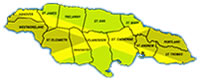
JAMAICA
Geography
Location: Caribbean, island in the Caribbean Sea, south of Cuba
Geographic coordinates: 18 15 N, 77 30 W
Map references: Central America and the Caribbean
Area:
total: 10,990 sq km
land: 10,830 sq km
water: 160 sq km
Area - comparative: slightly smaller than Connecticut
Land boundaries: 0 km
Coastline: 1,022 km
Maritime claims:measured from claimed archipelagic baselines
continental shelf: 200-m depth or to the depth of exploitation
exclusive economic zone: 200 nm
territorial sea: 12 nm
Climate: tropical; hot, humid; temperate interior
Terrain: mostly mountains with narrow, discontinuous coastal plain
Elevation extremes:
lowest point: Caribbean Sea 0 m
highest point :Blue Mountain Peak 2,256 m
Natural resources: bauxite, gypsum, limestone
Land use:
arable land : 14%
permanent crops: 6%
permanent pastures: 24%
forests and woodland: 17% other: 39% (1993 est.)
Irrigated land: 350 sq km (1993 est.)
Natural hazards: hurricanes (especially July to November)
Environment - current issues: deforestation; coastal waters polluted by industrial waste, sewage, and oil spills; damage to coral reefs; air pollution in Kingston results from vehicle emissions
Environment - international agreements:
party to: Biodiversity, Climate Change, Law of the Sea, Marine Dumping, Marine Life Conservation, Nuclear Test Ban, Ozone Layer Protection, Ship Pollution, Whaling signed, but not ratified:none of the selected agreements
Geography - note: strategic location between Cayman Trench and Jamaica Channel, the main sea lanes for Panama Canal
SHOWCASE
|
SHOWCASE
|
SHOWCASE
|