Pedro Bank
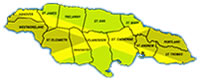
Parish: St. Elizabeth
Category: Underwater Cultural Heritage Sub-Category – Shipwrecks
Classification: Historic Site - Priority 1
section of the Taino site.
Historical/Archaeological Significance
Other than an abundant supply of birds and fish, Pedro Bank offered only hostility to early explorers and settlers alike. From surveys and excavations done on the Pedro Bank, it appears that among all nations, the Spanish may have suffered the largest losses in terms of people, ships and cargo valve. For example, the records show that in 1512, 1602, 1605, 1691, 1730 and 1755, Spanish vessels were lost on the Pedro Bank. Archival records describe in detail the shipwreck of 1691.
On the night of June 2, 1691 four merchant ships from the Spanish Armada y Festa de Tierra Firme (South American Fleet) returning to Spain via Havana (Cuba) from Cartagena (Colombia) sailing in poor weather suddenly ran aground on "Baja de la Vibora" a large and treacherous shoal area now known as Pedro.
Bank, 80 miles southwest of the island of Jamaica. The loss was significant. A document addressed to Lord General Marques del Vado in charge of the 1691 fleet from three deputies of Commerce at Havana states "the four (4) galleons under the command of your Lordship Santa Cruz, La Concepcion, El Angel and Nuestra Senora Del Carrea lost on the 'Baja de la Vibora' on the night of June 2. The people were saved by the warship Nuestra Senora de Regla. It is known that three (3) of the ships remained intact even though one suffered a fire that consumed the ship above the water line. It was found that in all four vessels portions of the silver remained, that for the quality of the weather and for the haste necessary in saving so many people, they were unable to remove the silver. Therefore, it is necessary to issue a decree to which effect the said silver be removed in as brief a time as possible in order that the English who are nearby in Jamaica, have no opportunity to arrive first and take it."
Inherent Features
Lying approximately 80 miles to the southwest of Jamaica is a mega like underwater shoal rising up from 500 fathoms or more and encompassing an area slightly smaller than Jamaica itself. Most of the water over the bank is navigable except for areas of submerged reefs and small cays that wind along the southern edge of the bank. Vast stretches of underwater reefs are covered with a dense growth of Elkhorn coral, which to a wary mariner could easily appear to resemble fangs of a snake. The Spanish viewed the bank as a hostile and dreaded place. The eastern end was referred to as "la Cabeza de la Vibora" (the head of the viper) while the southwestern end was known as "el Cascabel" (the tail of the viper).
The location of "la Vibora" was treacherous for it intruded into the historic Spanish trade route. Moreover, the prevailing winds and the equally dangerous Seranilla Bank further to the southwest left only a relatively narrow passage for
Donald G. Geddes: Paper at the conference on Underwater Archaeology under the auspices of the society for Historical Archaeology, Reno, Nevada, January 15, 1988.
SHOWCASE
|
SHOWCASE
|
SHOWCASE
|